Based on our previous post, I went ahead and sent an email to Metra reflecting my thoughts on the proposed BNSF schedule. For some of you reading this, this is the inaugural post of Star:Line Chicago, so enjoy! This is the kind of advocacy we’ll be rolling out in the future. As a reminder, if you want to send in your own comments to Metra for their proposed BNSF changes, shoot an email over to BNSFservice2018@metrarr.com.
To whom it may concern:
I am writing in regards to the proposed changes to Metra’s BNSF schedule. First and foremost, I would like to thank Metra for opening up the proposed schedule changes to public comment. Seeking feedback from your riders on proposed schedule changes is admirable, and I sincerely hope the input you receive is both constructive and instructive as to what Metra’s ridership would prefer in changes to existing service.
Secondly, I would like to thank Metra for taking the initiative to add additional time when flipping trains. While I am aware that investments in Positive Train Control (PTC) are prompting this recommended change, additional buffer time between trains will help Metra maintain schedule adherence and help absorb minor delays when they occur so late trains don’t get any later. This is an admirable goal, and I thank Metra for pursuing it. However, having reviewed the proposed schedule changes, I have many concerns about how this will affect BNSF ridership — myself included as a regular commuter from LaGrange Road.
First and foremost, I don’t understand why additional time to flip trains is required as part of PTC implementation. For Metra and the BNSF to spend tens of millions of dollars on a safety system that can’t be operated in push-pull mode seems to be a significant missed opportunity. Furthermore, while I understand both Metra and BNSF treat safety as job number one (as they should), the utility of an entirely separate job briefing when flipping a train — even if the train is deadheading back to Union Station or to an outlying terminal — seems wasteful and could easily be consolidated into a briefing at the beginning of a dedicated out-and-back run rather than a trip in each direction. As such, I am not convinced that the BNSF requires as much additional time to flip the train as reported by Metra and the BNSF.
Secondly, while adjusting schedules to address crowding issues in the AM Peak is admirable, adjusting schedules for PM Peak crowding is not needed. Bluntly stated, riders on outbound trains who cannot find seats during the afternoon peak simply did not arrive at Union Station early enough. If riders barely make the outbound departure and must stand, so be it: I am sure that many Naperville/Route 59 riders would rather stand for 32 minutes than sit on a train that takes 45+ minutes to reach their stations. However, riders on inbound trains in the morning do not have that luxury; the train is as crowded as it is when it gets to your station and boarding passengers must deal with it. While an additional inbound express train from Aurora-Route 59-Naperville was added in the proposed schedule, the new schedule shifts the morning peak period deeper into the midday period, with some express trains arriving at Union Station after 9am. Adding that additional Aurora-Route 59-Naperville express train comes at the expense of pushing a Lisle-Hinsdale express train to arrive at Union Station after 9am as well as pushing a Fairview Avenue-Congress Park train to arrive at Union Station at 8:59am. As I’m sure most of the comments you’re receiving will tell you, in my experience the busiest trains of the AM peak period arrive downtown before 8:30am. Pushing some of these trains to arrive at Union Station later will encourage existing riders to move to earlier trains, which is not only an inconvenience (no one wants to wake up earlier) but also adds additional riders to trains you want to decongest, which is counter-intuitive. To address crowding at Naperville, I recommend instead converting the morning schedule to something more similar to the afternoon schedule, where Aurora riders utilize Lisle-Belmont-Downers Main trains and reserve dedicated express service to Route 59 and Naperville (your #1 and #2 suburban ridership stations).
Thirdly, the changes to the PM Peak schedule unnecessarily complicate the schedule, which raises an additional barrier to entry for new or infrequent riders. The existing schedule is complicated enough as it is — in two instances, I personally get back to LaGrange Road sooner on certain express trains that leave after earlier local trains — but this proposed schedule takes that to an entirely different level. The proposed schedule aligns express trains to arrive slightly after earlier local/other express trains, so intermediate riders who may not be coming from downtown will miss potential connections by a matter of minutes. Currently, trains can be grouped into roughly four express zones: Aurora/Lisle-Belmont-Downers Main, Naperville/Route 59, Hinsdale-Fairview Avenue, and Congress Park-Highlands. Some trains will combine two of those zones, but otherwise the schedule is pretty consistent. Under the proposed schedule changes, however, west of Hinsdale riders will need to know what individual trains stop at their station in extreme detail, since the stopping patterns on the proposed trains do not appear to follow much rhyme or reason. This again contributes to a significant barrier for potential new riders and makes the system much more unfriendly, and has the potential to make significant delay situations at Union Station that much more inefficient and problematic for riders. Furthermore, the proposed schedule increases scheduled travel times from Union Station to Naperville by a full 25% (from 32 minutes to 40 minutes): and as your second-busiest station which deals with AM crowding in exchange for perhaps the best commuter rail express service in the country, this is probably a non-starter for a significant number of your riders.
In summary, with the coming changes of PTC, the way I see it Metra has two options: either work with the PTC implementation to fit the existing schedule as well as possible, or use this opportunity to throw out the existing BNSF schedule and rebuild it from scratch, focusing on existing and projected ridership habits and trends to create a schedule that prioritizes moving riders, not trains. Instead, it appears that Metra is taking the bold approach of doing neither of those, tweaking the existing schedule somewhat arbitrarily rather than doing something truly bold and squandering an opportunity to reverse the slow loss of ridership from the BNSF we’ve seen for the past several years. Metra’s BNSF service is an absolute asset to the entire Chicago region, and I do not see how these schedule changes improve satisfaction of existing riders or encourages other commuters to become Metra riders.
I encourage Metra to use this opportunity to reimagine the entire BNSF schedule to better serve current and potential riders and to take these considerations into account when adjusting schedules on other Metra lines as PTC continues to roll out.
Once again, I appreciate the opportunity to provide feedback on the proposed BNSF schedule changes, and I look forward to supporting Metra in the agency’s goal to provide better transit service for suburban Chicago.
As a reminder, today we’re rolling out STAR:LINE Chicago, The Yard Social Club’s new transit advocacy group focusing on the Chicago suburbs. We’re on Facebook, on Twitter, on Instagram, and right here on Diverging Approach.
I was initially planning on using my next Diverging Approach entry to discuss fare capping, which is a new kind of fare structure that gets rid of ten-ride and monthly passes in favor of a system of tracking fare purchases which then apply automatic discounts when a rider reaches a certain number of purchases in a designated period of time. Fare capping is a great way to make transit more affordable and attractive for lower-income riders without actually changing ticket prices, since riders no longer need to pay a large up-front fee for a monthly or weekly pass and discounts are automatically applied. GO Transit up in Toronto currently uses this system for their commuter rail service. (GO Transit also uses a proof-of-payment fare collection system similar to CalTrain in the Bay Area rather than Metra’s antiquated conductor system.)
However, two things happened: first, otherpeople in the transit blogosphere created far better media than I could; and second, Metra decided to slide out a new proposed weekday schedule for the BNSF due to Positive Train Control (PTC) coming online. Go ahead and take a look, and compare it to the current schedule. (Weekend schedules are not affected at this time, thankfully.)
With PTC coming online, trains will need more time to flip at the end of their respective trips. According to Metra’s dedicated FAQ on the updates, BNSF anticipates a minimum required flip time of 12-15 minutes for the train crew to clear the train, check the brakes, have the engineer change ends of the train, initialize PTC, and perform a job briefing before the train can restart. (Why each flip requires a separate job briefing, I don’t know; seems to me like trains can be organized into runs like CTA trains and transit buses and have a single job briefing before the run as a whole instead of at the beginning of each trip.) Giving more time between flips is definitely worth looking at, PTC or not, just to ensure a higher level of service reliability and give trains more buffer time in case they start to fall behind, rather than the cascading delays that are relatively frequent along the congested BNSF corridor.
While popping the hood on the BNSF schedule, Metra rightfully chose to take a look at what can be done about passenger crowding as well, and that’s where things take a very ugly turn. Metra is proposing this new schedule to ease crowding with a particular focus on Naperville and Route 59, and they missed the mark pretty dramatically while making things objectively worse for just about every other station on the line.
One thing to make clear, from a mid-route rider’s perspective: trains feel more crowded in the morning than in the afternoon, whether or not there’s actually more people on the train. The reason is simple: in the morning, whenever you get on the train, if you want a seat you have to find what’s available based on passenger loads from the stations served by the train before it gets into your station. In the afternoon, on the other hand, if you want a seat, all you have to do is get to the train a little earlier since the train starts out empty in Union Station.
Any regular commuters from Naperville will tell you that even with the Aurora-Route 59-Naperville super-express trains in the morning, seats can be tough to come by. The proposed Metra BNSF schedule does not do much to address this: a ninth inbound express train was added to the schedule, but at the expense of moving the last inbound express train later to arrive at Union Station after 9:00am, as well as moving a second express train serving Lisle-Hinsdale after 9:00am, and moving a third express train serving Fairview Avenue-Congress Park to 8:59am. If your workday starts at 9:00am and you currently take those late expresses (which I would guess is a not-small portion of the downtown workforce), the proposed schedules will push those riders back further into the meatier part of the peak period, which may be counter-intuitive if you’re trying to decongest the trains. A better alternative would be to divorce Aurora from the Naperville-Route 59 trains, similar to the existing outbound express scheme. While this would require additional operating time to allow the train to travel the extra distance, it would give greater capacity to your busiest- and second-busiest stations outside of downtown on Metra’s most premium service.
There’s also a bizarre shadow express train running right behind a local-express train (Trains 1248 and 1250, if you’re playing along at home) between Fairview Avenue and LaGrange Road. Train 1250 almost catches train 1248 at LaGrange Road (eight minutes behind!) then follows in 1248’s wake even after 1248 stops at Western Avenue and Halsted Street to arrive at Union Station only five minutes behind 1248. I have no idea what’s going on with that train, other than potentially adding capacity to a handful of stations in the middle of the line (which probably could be accommodated by a longer train instead).
And then there’s the afternoon service, which is supposedly based on passenger loading but looks like Metra’s schedulers just drew stops out of a hat for the express peak service. When you’re trying to get more people to ride your trains, don’t make the schedule more intimidating and complicated.
Metra’s current outbound express pattern on the BNSF is plenty complicated, of course, but it can be grouped into the following general categories (as we’ve done on this site):
The proposed schedule has the following trip formats for the far-out stations, moving from early to late:
2 Downers/Main-Aurora express trips (not bad on the shoulders of the peak)
A Fairview Avenue-Aurora express trip (which, for extra credit, arrives at Fairview Avenue 9 minutes before the local train behind it, which precludes intermediate local trips through Downers Grove)
A Naperville-Aurora express trip (Aurora was split off of these trips a few years ago due to overcrowding issues…)
3 Lisle-Naperville-Aurora express trips
3 Downers/Main-Belmont + Route 59 express trips
A Hinsdale-Route 59 express trip (that doesn’t stop at Belmont, because reasons)
One last super-express Naperville-Route 59 trip
One last Downers/Main-Lisle + Aurora trip
If you live east of Downers Grove, the proposed changes are less dramatic, but maybe more significant. What we call the O-P zone (Congress Park-Fairview Avenue) lose express trains departing Union Station before 5:00pm, with the possible exception of a significantly-later limited train between Union Station and LaGrange Road, moving from 4:37pm to 4:52pm. Congress Park, which has shown relatively dramatic gains in ridership, is rewarded by losing an outbound train. West Hinsdale and Highlands also each lose an outbound afternoon train.
All in all, Metra has an opportunity to dramatically reshape the entire structure of the BNSF schedule to better serve riders (both current and potential new riders) with the introduction of PTC. However, the schedulers are still stuck in the mindset of simply tweaking the current schedule resulting in stopping patterns that resemble Swiss cheese and significantly raise the learning curve for new riders rather than throwing the whole thing out and starting new, which is what needs to be done. Instead of sneaking new trains in here and there and moving station stops from train to train, wipe the slate clean and try something bold. Metra will attract new riders if they made the BNSF easier and more intuitive to understand; or, in the absence of that, if they found a way to tighten up that 12-15 minute flip time and keep the current schedule that we’ve more or less gotten used to. (I’m currently writing this onboard an Amtrak train that flipped in Bloomington-Normal in about seven minutes while discharging and boarding passengers; not sure why that couldn’t be done on a Metra train.)
This schedule is going to really, really piss off people in Naperville, which may not be the constituency you want to piss off since they’re your second-busiest outlying station. Naperville riders deal with crowded morning trains to get their super-express service that gets you from Union Station to Naperville in 32 minutes; they will get their four super-expresses cut in half, with service instead stopping at Lisle and adding eight minutes to the trip – a 25% increase over today’s schedule. Route 59 riders — at Metra’s busiest outlying station — probably won’t be too pleased either, since their trains will also add a stop (Downers/Main and Belmont instead of only Naperville).
Faced with an opportunity to either strengthen the status quo or try something dramatically progressive and different, Metra is taking the bold stance of doing neither. Unfortunately, BNSF riders will bear the brunt of these changes and ridership will suffer.
TL;DR: Metra is making the schedule needlessly more complicated and should be using PTC implementation as an opportunity to reimagine BNSF service from scratch rather than moving the same trains around to make slightly different stops.
If you’d like to give Metra your two cents on the proposed service modifications, send an email to BNSFservice2018@metrarr.com by April 15. Or, if you want to make a scene about it, there’s a board meeting tomorrow morning at 10:30am.
First and foremost, thank you to everyone who tagged along on this year’s Itasca St. Patrick’s Day Parade. We had a great year, and this was one of our most well-attended St. Patrick’s Days in recent memory. The Yard Social Club began organizing Metra trips following the last “perfect storm” year where St. Patrick’s Day landed on a Saturday and the trains and downtown were far too crowded for our liking.
And, of course, this year was just like that as well.
First and foremost, even though we planned ahead and negotiated an official 65-person group rate with Metra, the railroad was still caught off-guard by just how deep we rolled from Itasca. While some of that was no doubt part of overall crowding on the system — our 9:23am train had a whopping ten cars, compared to the MD-W’s typical 6- or 7-car consist — no one told our train crew that they had a large group boarding at Itasca. Likewise for the flip trip on the 4:30pm train out of Union Station. I’m looking forward to touching base with Metra and giving them some constructive feedback based on our experience.
Secondly, I apparently wildly misjudged the level of interest in discounted tickets this year. Probably a combination of the Weekend Pass going up to $10 this year and me scaling back our group size after eating a few tickets last year, we had 63 of our 65 tickets spoken for before I arrived at the pre-party. While I’m happy that so many of you chose to use our online registration to get your tickets before the day of the event, having a better idea of the level of interest further ahead of the event would’ve allowed me to change the group size with Metra before the event and get more people in the discounted rate. (Metra’s Group Rates rules require any changes in group size to be submitted no later than 21 days before the event, and requires payment in full no later than 14 days before the event.) While I don’t think the base price will change for 2019, here’s an early warning: prices for tickets will go up for people who aren’t registered by the end of February.
Thirdly, downtown was far too crowded. I will give the Berghoff kudos for expanding their bar area, which made our traditional first stop much more enjoyable. However, our secret is officially out in regards to The Bar Below: while the bar wasn’t that crowded at first, bringing a group of 80 people to a single bar will wildly swing how crowded that bar feels and how fast we can get drinks at the bar.
The good news is, thanks to some upcoming leap years, the next “perfect storm” year won’t happen until 2029. Hopefully next year will be a little less crowded downtown. That said, I did have a few ideas to make next year run smoother for all of us:
Earlier coordination with Metra. I plan on working more closely with Metra next year to make sure Metra has a better idea of what to expect when we roll into Itasca. We get our discounted ticket rate by using Metra’s group fares, which means Metra (theoretically) knows to expect a huge group to board on certain trains. While Metra can’t guarantee private train cars for groups (obviously), if the train crew knows ahead of time to expect a group of 80 people, they usually try to hold a car for us. (Each Metra car officially seats about 125 people.)
Variable trains home. Every year, some people opt out of our discounted group tickets since that 4:30pm outbound trip isn’t attractive for many people. (I know others of you just humor me and buy our discounted tickets, knowing you’ll need an extra fare to get back to the suburbs — and I thank you for that.) However, with a large enough group, we may be able to reach a critical mass to allow for variable trains home: Metra’s group fare rules won’t let the group rate be a blank slate for any train you want (as someone inevitably finds out the hard way every year, no matter how many warnings I put on the registration forms and the tickets themselves), but I may be able to finagle splitting our group up onto two or three different trains home. Of course, this involves ticket holders to plan ahead and anticipate what train to take home — and y’all aren’t the best planners in the world, and definitely not moreso after a day of drinking. Furthermore, there needs to be a certain critical mass of people in the group for Metra to entertain group rates. Here’s my proposed set-up for next year; please leave me some comments and feedback on your thoughts and how interested you would be in the various options:
9:23am inbound: We all leave Itasca on the 9:23, per tradition.
Early outbound: small group (25% or so of the total group) gets the 1:30pm departure, which lets you join us for the Berghoff and The Bar Below, then head back to Itasca early.
Traditional outbound: reserved for about half of the group, our traditional 4:30pm departure gets us back to Tree Guys by 5:30.
Late outbound: the last 25% of the tickets would be reserved for people spending extra time downtown and taking the 8:40pm train home.
As always, your thoughts and feedback are always appreciated, so contribute your two cents in the comments below, or send your hate mail straight to scott@yard-social.com. I’d like to thank the entire McDonald family once again for being such gracious hosts, for starting this tradition years and years and years ago, and for continuing to put this great event together year after year. See you next year!
Daniel Biss, a sitting Illinois state senator and a Democratic candidate for governor, duffed a transit question in a televised debate this week. A moderator asked Biss how much he believed a monthly CTA Pass costs. Biss’s response:
“A monthly CTA pass. Now, let’s see. My Metra pass now comes pretty close to $50 a month. So A monthly CTA pass I would guess is probably around $35.”
A CTA 28-Day Pass costs $105, more than three times Biss’s guess. Following the debate, Biss’s campaign tried to explain the discrepancy, but duffed that too:
Biss’ campaign later said the Evanston senator “mixed up” the weekly and monthly pass prices, and was referring to the weekly Metra pass at $55, and the weekly CTA pass at $35.
Metra does not offer “weekly” passes. Metra does offer a 10-Ride Ticket, but if a rider is using all ten rides in a single week, a Monthly Pass is a more cost-effective alternative.
However, it does bring up a valid question for many Metra commuters: when should I buy a monthly pass, and when should I just use 10-Rides?
As part of the most recent (February 2018) fare hikes, Metra adjusted their ticket structure slightly. (Metra is currently studying a more dramatic shift to their overall fare structure.) All Metra fares are based on one-way ticket prices between five-mile-wide fare zones throughout the region, starting downtown at Zone A and radiating out to Zone M in Harvard. From the one-way ticket price, 10-Ride tickets are priced at 9.5 times the cost of a one-way (up from 9x) and monthly tickets are priced at 29 times the cost of a one-way (up from 28.5x).
Since there is a discount for 10-Rides and 10-Rides are good for a full year (except when purchased in January, when many riders try stockpiling to beat the annual February fare increase), a 10-Ride will always be the most affordable per-ride ticket for infrequent riders. However, for more frequent riders, the “sweet spot” is your 30th ride: if a rider takes 30 or more Metra rides in a calendar month, a Monthly Pass will be the better per-ride value. In other words, if you’re commuting downtown at least 15 days in a month, buy a Monthly Pass. This is true regardless of the fare zone.
Of course, since Metra sells Monthly Tickets based on calendar months, even if your work schedule never changes, you may want to change your ticket. A typical month includes 20-22 workdays, but thanks to holidays, vacations, etc. a 18- or 19-day workday month is not unusual. Add in flexible work assignments and that 15-day target can easily become variable between months.
Granted, if it’s that close, you’d probably only save a few bucks here or there, but every dollar counts.
Next up: DA will offer up an interesting tweak to the fare structure that’s probably revenue-neutral but more equitable for lower-income riders.
Welcome to Diverging Approach, the official blog of The Yard Social Club! In addition to regular site updates, I’ll be using this space to post some transit-related ramblings from time to time in the hopes of entertaining, educating, and encouraging changes in the Chicago regional transportation network. This blog will be updated occasionally, but like everything else on this website it’s a labor of love so updates may be in fits and starts.
As for the blog name, I chose “Diverging Approach” for three reasons:
“Diverging Approach” is a railroad signal aspect, commonly shown as a red signal over a yellow signal. This aspect indicates that the switch ahead is aligned for a train to change tracks at low speed.
This blog will likely provide some food for thought for potential ways Metra can improve, literally offering a “diverging approach” to how the railroad is run.
And last but not least, I can easily abbreviate references to Diverging Approach as “DA blog”, which fits right in with everything else in Chicago.
Comments will be turned on for most DA blog posts, so feel free to join the conversation and leave your two cents. New Diverging Approach posts will also automatically pop up on The Yard Social Club’s Twitter (@YardSocialClub), so follow along there to not miss an update.
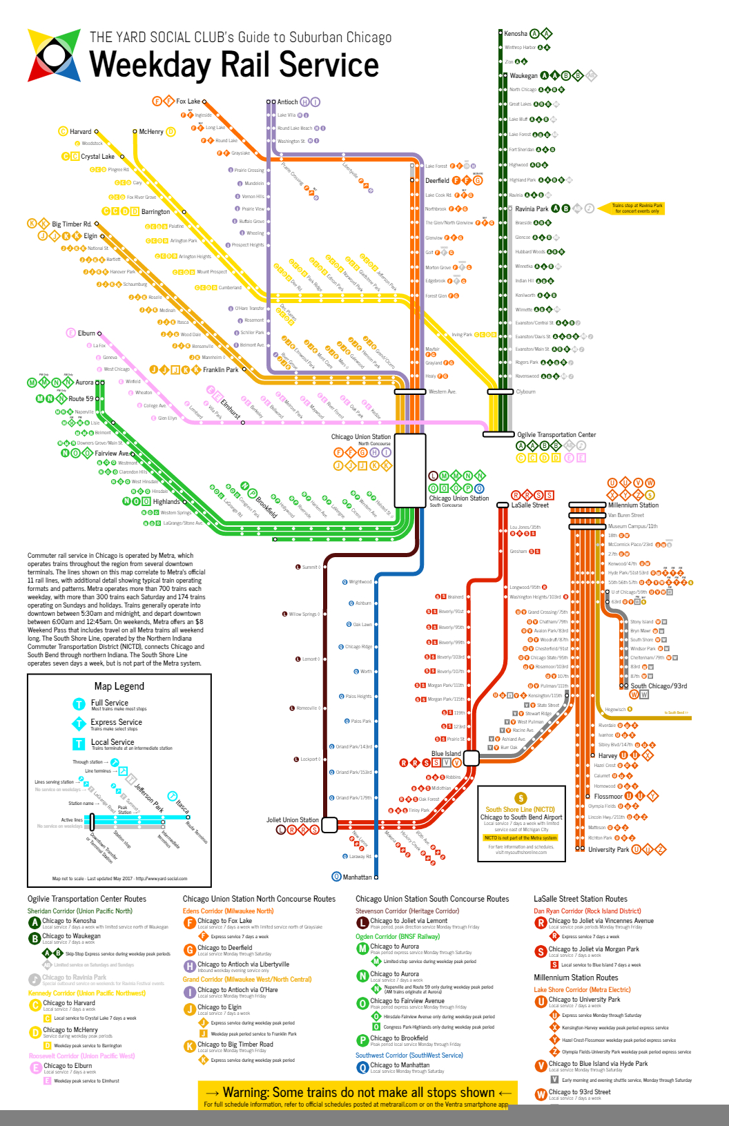
Editor’s Note (Nov 26, 2020): A new version of our map is now available with more details here. This page will be updated accordingly in the near future.
Nothing Metra does can be easy, and their line nomenclature fits right in. Metra operates a legacy network of commuter rail service, and as such most of their lines are named after their host (or former host) railroads. While this serves as a semi-interesting history lesson, it makes for a network that is less than intuitive for infrequent riders.
Metra’s official map is… well, it’s fine. Metra’s online map offerings are more robust, with a GIS base so you can zoom in, click around, and even see individual trains in real-time when you look on a per-line basis.
Metra’s official map, as seen at Chicago Union Station in June 2018.
I had two primary concerns with Metra’s map. First and foremost, it can be confusing — but granted, most of the confusion comes from the line names Metra chooses to use. (More on that in a bit.) But the other issue is that the map makes no effort to delineate service frequency and chooses to focus on regional coverage instead. That’s fine for peak periods (where, admittedly, the lion’s share of Metra’s ridership uses the system anyway), but from the map it’s impossible to know that two of the above Metra lines have no weekend service whatsoever, with another line offering very limited Saturday service and no Sunday service. And then there are the branch lines, which may also have much more limited service. (Or, in the case of the South Chicago or Beverly/Morgan Park branches, they may not.)
You see where this is heading.
Since I can’t leave well-enough alone, I developed my own map and naming scheme for the Metra system. It goes without saying that some of the more creative aspects of this plan are used exclusively on this website, so don’t go asking Metra staff where the Arrow Line is or anything like that. But I may occasionally use our short-hand around Diverging Approach and in our Weekend Guides.
Click the map for a larger view of the JPG. Or click here to see the map as a PDF.
The map, which is formatted to 11″x17″, was conceived as a flower floating on the shore of Lake Michigan. The map otherwise mostly throws local geography out the window, although care was taken to make sure that the respective lines cross in the right places and that the downtown terminals are positioned somewhat correctly relative to each other.
From there, the lines and stations are drawn based on service frequency: generally, the more a line and station looks like the lines and stations on the CTA map, with bold lines and white circles at the stations, the more Metra service that location gets. (Note for the uninitiated: Metra’s off-peak service is nowhere near as frequent as the CTA. The highest frequency we show on our map is “Core Service”, which means service no worse than once every two hours off-peak. That’s also why we used the word “Core” instead of “Good” or “Full” or “Standard”, because any of those terms should be used for off-peak service that’s, you know, good.) As the frequency and/or days of service decrease, the lines get lighter and the stations blend in more with the line behind it, until peak-only services are shown only as light gray dots on a barely-there white line. Our map also looks at what we called “extended service”, where certain trains continue further out into the hinterland at lower frequencies. On the map, these are shown as narrower lines, which indicate that those stations still get service as shown on the map, but not at the same frequency as stations closer to the urban core.
With a hat-tip to the New York City Subway system, I initially developed our naming scheme first based on a lettering system to differentiate Metra from the CTA’s rail lines (which are color-coded) and the CTA and Pace bus networks (which are numbered). Generally, Metra lines are lettered increasing in a counter-clockwise manner from north to south, with groups of letters based out of the four/five downtown rail terminals. I subdivided Union Station into a North Concourse and a South Concourse, based on the raw number of trains that leave Union Station relative to the other terminals. I also divided the Rock Island into two separate lines and the Metra Electric into three separate lines, which I feel more accurately indicates the services offered.
For lines that offer express services during peak periods, the line may have a secondary letter as well. Peak-only supplemental services are identified on our map with either the secondary letter in a diamond (to show express trains) or the primary letter in a square (to show “short-turn” local trains). Generally speaking, all local trains will use the primary letter, and all express trains will use the secondary letter. Since all Metra trains are numbered relatively consistently (outbound trains are odd numbers; inbound trains are even) One of the perks of a lettering system is that individual trains can easily be referred to as a combination of the line letter and train number, which even inline in text can immediately tell the reader basic information about the train in question (e.g., train K2215 is an outbound MD-W train; train R417 is an outbound RI train that does not serve Beverly and Morgan Park).
Let’s be honest: the map is still very confusing, and it’s worth noting that I’m not an expert cartographer. However, that’s also kind of the point of the entire exercise. One of Metra’s biggest strengths in the region also happens to be one of it’s biggest weaknesses: branding itself as a single, cohesive regional network, when in reality each line has it’s own quirks in how service is delivered.
In the most recent update, I also had a little extra fun and refined our suggested proper names for each line as well. Originally, the map referred to trains as “Corridors” that paralleled a major highway heading towards downtown Chicago. That old system had plenty of flaws: the Old Guard wasn’t a fan that we divorced some railroad history from the rail lines, and the Urbanists weren’t terribly happy that we contextualized transit services in terms of highways. (And there were a few difficult choices that had to be made, like having no “Eisenhower Corridor” since both the UP-W and BNSF do the job.) Instead, I put my thinking cap on, dug through the Internet, and came up with something totally unique: names based on former long-distance passenger trains that previously served the line in some way, shape, or form. This had a few benefits:
It’s simple. Each line has an easy-to-remember one- or two-word name.
It honors the past. As a rule, Diverging Approach tries to nudge Metra forward into the future, not backwards into the past, but Chicago’s rich railroad history deserves to be celebrated.
It strikes a balance between the two. One of the biggest critiques of the current Metra naming system is that it’s not terribly intuitive for new riders, and looking at the system as a whole can be way too easy to confuse. For instance: there are two North Lines, two West Lines, and a Northwest Line; there are three lines with “Union” in the name and none of them go to Union Station; the Rock Island and Metra Electric lines can each be better thought of as multiple, coordinated services; there’s dangers of forced future name changes if more railroad consolidation in the market occurs; and so on. Our naming system gets rid of all that and modernizes the system, but still connects back to the original railroads who built the network.
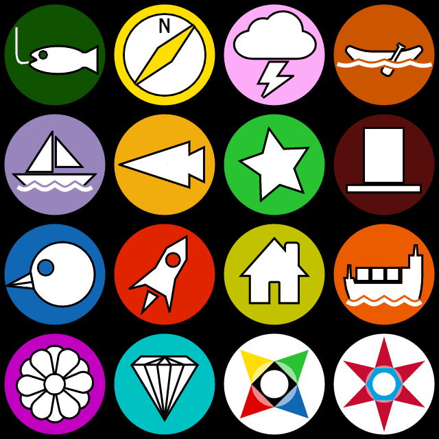
It’s fun. To make things easier to remember and identify, the new naming system also includes individual icons for each line. And better yet, each icon has a corresponding standard-issue emoji for smartphone users because, hey, why not?
Below is a list of our reimagined names (and letters and icons and emojis) for each Metra line.
The Ashland Line Union Pacific North (A) Daily core service to Waukegan with extended service to Kenosha <B> Weekend outbound express trains to Ravinia Park for events
History: The Ashland Limited was a Chicago and North Western train from Chicago to Ashland, Wisconsin, via Green Bay. I was tempted to go with the Flambeau, another C&NW train that used what’s now the North Line, but as a true blue Chicagoan I couldn’t in good conscience go with a name so similar to “Lambeau” on the only line that goes into Wisconsin and has a forest green color scheme to boot. (The forest green color Metra uses is officially “Flambeau Green”. You’ll see I overlapped a few of these line names with Metra’s throwback color names, so I’m hoping that could be a foot in the door to actually making some of these changes.) Plus, the corridor parallels Ashland Avenue pretty closely in the city, so that’s good enough for me.
Line Icon: A fish, being fished. (The Ashland Limited was also occasionally referred to as the Fisherman’s Special or the Northwoods Fisherman.)
Emoji: 🎣
The North Western Line Union Pacific Northwest (C) Daily core service to Crystal Lake and extended service to Harvard <D> Peak period express service to Harvard or McHenry
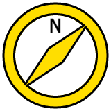
History: The North Western Limited was the Chicago and North Western’s primary train between Minneapolis-St. Paul and Chicago before the streamlined 400s were used. This one could have also been called “The Viking Line” for the C&NW’s Viking; Metra uses “Viking Yellow” for the color. Honestly, I’m playing a little fast and loose with this one: the North Western Limited used today’s North Line up to Milwaukee before heading to the Twin Cities, but considering it’s currently the Northwest Line that parallels Northwest Highway and used to be operated by the Chicago and North Western, let’s keep this one simple. (And it did operate over the current UP-NW’s tracks between Ogilvie and Clybourn, after all.)
Line Icon: A compass. (And yes the compass is pointing in the correct direction: since the needle always points north, if you’re heading northwest, this is what the compass should look like.)
Emoji: 🧭
The Kate Shelley Line Union Pacific West (E) Daily core service to Elburn <F> Peak period express service to Elburn
History: Kate Shelley has a prominent place in railroad folklore. An Irish immigrant living in Iowa in 1881, she overheard a C&NW inspection locomotive wreck into Honey Creek following a bridge washout during a round of severe thunderstorms. Since a passenger train was due through the area later that night, Kate ran through the storm to a nearby train station to alert railroad staff of the wreck. Her quick thinking saved the passenger train as well as two of the crew members from the initial wreck. C&NW would later run the Kate Shelley 400 over what’s now the Union Pacific West Line between Chicago and Iowa. It’s never a bad time to celebrate another brave woman in Midwestern history. (Plus Metra already officially uses “Kate Shelley Rose” as the color for the line.)
Line Icon: A thunderstorm.
Emoji: 🌩
The Marquette Line Milwaukee North (G) Daily core service to Fox Lake <H> Peak period express service to Fox Lake and weekday evening reverse commute express service from Antioch
History: The Milwaukee Road ran the Marquette from Chicago to Madison and points west over what’s now the Milwaukee North (before the Illinois Tollway effectively killed demand for passenger rail service into Wisconsin).
Line Icon: In honor of early Midwestern explorer Father Jacques Marquette, who cut through what’s now Chicago in 1673, this line uses a canoe.
Emoji: 🛶
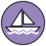
The Laker Line North Central Service (J) Weekday basic service to Antioch
History: Metra’s service now operates over tracks controlled by Canadian National, but way back when, the Soo Line operated The Laker between Chicago and Duluth over this corridor (north of Franklin Park). Interestingly enough, the line between Franklin Park and downtown swung south and paralleled what’s now the Blue Line in Oak Park and Forest Park, which makes a fun corridor to discuss in the context of the O’Hare Express. “The Laker” is also a good name for this corridor since it cuts right up through the center of Lake County.
Line Icon: A sailboat. Maybe on the nearby Chain O’Lakes.
Emoji: ⛵️
The Arrow Line Milwaukee West (K) Daily core service to Elgin with weekday extended service to Big Timber Rd (L) Peak period express service to Big Timber Rd
History: The Arrow was the Milwaukee Road’s Chicago-to-Omaha train, which operated over what’s now the Milwaukee West corridor. Metra calls the color “Arrow Yellow” after the train, but personally I feel like “yellow” is a bit misleading.
Line Icon: I used a stylized arrowhead, pointing left (west) as a hat-tip to the current Milwaukee West name.
Emoji: There’s no direct arrowhead emoji and I feel like one of the standard arrows is a little too, uh, direct… but there is a bow-and-arrow, so whatever, close enough. 🏹
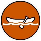
The Western Star Line BNSF Railway <M> Mon-Sat peak express service to Aurora (N) Daily core service to Aurora <O> Weekday peak express service to Fairview Avenue
History: I really, really wanted to use the Zephyr here; the last version of the map that I posted in the last blog post still had the Zephyr listed. But, since this line does serve Union Station, and since Amtrak runs both the California Zephyr and the Illinois Zephyr over this same route, I unfortunately decided that it’d be too easy to confuse. I also considered the Mainstreeter, which is just a cool name for a train plus would be pretty representative of the small towns served by this Metra service, but I opted against it since there’s literally a “Main Street” station on this line (as well as one on a different line). That left the Western Star, a Burlington/Great Northern train that connected Chicago to Spokane via Glacier National Park. Plus, hey, a Star Line!
The Abraham Line Heritage Corridor (P) Peak period express service to Joliet
History: It’s nice when history is still current. The Alton Railroad began the Abraham Lincoln in 1935, and since then the operators have changed (from Alton to Gulf, Mobile and Ohio, and on to Amtrak) but the long-distance train keeps rolling today as Amtrak’s Lincoln Service. To distance the Metra line from the Amtrak service, I kept the Abraham and dropped the Lincoln.
Line Icon: Lincoln’s trademark stovepipe hat. If regular Heritage Corridor riders prefer to see it as a tombstone, hey, go for it.
Emoji: 🎩
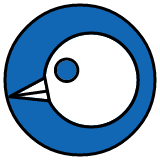
The Blue Bird Line SouthWest Service (Q) Weekday core service to 179th St with peak period extended service to Manhattan and very limited Saturday service to Manhattan
History: The Wabash Railroad originally ran the Blue Bird (and the Banner Blue, which Metra uses as the color of the line) between Chicago and St. Louis via Decatur. If only the Wabash ran the awesomely named Cannon Ball over this route instead.
Line Icon: It’s a bird’s head. Or at least it’s supposed to be a bird’s head. I’m not good with animals.
Emoji: Another iPhone/Android conflict here: Apple’s bird emoji is actually blue (doesn’t look too dissimilar from my icon, actually); other emoji libraries use a bird that looks more like a cardinal here. When in doubt, add the blue ball in front. 🔵 🐦
The Rocket Line Rock Island – Main Line (R) Daily core service to Joliet via Blue Island (RS) Daily off-peak core local service to Joliet via Suburban Line
History: When Amtrak was first formed in 1971, the government offered railroads a simple deal: pay a small fee and/or give Amtrak your passenger rolling stock to let Amtrak run passenger service, and in return the freight railroads would no longer be on the hook for providing (money-losing) passenger service. The Rock Island was one of six railroads that opted out of joining Amtrak, continuing to run their famed Rocket trains into the 1970s. In Chicago, the Peoria Rocket and the Des Moines Rocket (later the Quad Cities Rocket) operated over the Rock’s tracks between downtown and Joliet.
Line Icon: A rocket, theoretically flying north-northeast from Blue Island to LaSalle Street Station.
Emoji: 🚀
The Suburban Line Rock Island – Suburban Branch (S) Daily core service to Blue Island via Beverly/Morgan Park (RS) Daily off-peak core local service to Joliet via Beverly/Morgan Park
History: Another freebie, the Suburban Line has been known as the Suburban Line (or Suburban Branch, depending on the source) since before the Great Chicago Fire. Since in our lettering scheme the Rock’s Rockets are R trains and the Suburbans are S trains, no need to get too deep in the weeds here.
Line Icon: A single-family house. Picket fence and 2.3 kids not included.
Emoji: 🏠
The Panama Line Metra Electric – Suburban Main (U) Mon-Sat core express service to University Park (UV) Daily off-peak core local service to University Park
History: The most famous Illinois Central train that doesn’t have a song written about it, the Panama Limited was one of the most luxurious trains in the country, connecting Chicago and New Orleans over the Illinois Central’s main line. The original train was named after the Panama Canal, which was still being constructed when service first started.
Line Icon: Since the train was named after the Panama Canal, the icon is a (very crude) container ship.
Emoji: 🚢
The Magnolia Line Metra Electric – City Main/Blue Island Branch (V) Daily core service to Kensington/115th St with Mon-Sat extended service to Blue Island (UV) Daily off-peak core local service to University Park
History: The Panama Limited was one of the most luxurious trains in the country, with an all-sleeper consist. In 1967, as the Panama Limited was losing ridership (along with just about every other passenger train in the nation), the Illinois Central threw a few coach cars onto the Panama Limited and briefly called the coach accommodations the Magnolia Star, probably to try not to sully the luxurious reputation of the Panama Limited. I wonder if there’s some sort of allegory in there for how Metra treats suburban riders vs. city riders…
Line Icon: A simplified magnolia bloom.
Emoji: 🌺
The Diamond Line Metra Electric – South Chicago Branch Daily core service to South Chicago/93rd St
History: The Diamond represents a few different Illinois Central trains, including the Green Diamond, the Diamond Special, and the Night Diamond between Chicago and St. Louis. While the South Chicago Branch never hosted long-distance trains (for obvious reasons), these trains still share the old Illinois Central main line into downtown north of 63rd Street.
Catch Olympics fever yet? This summer, Yard Olympics will return with teams of five competing in bags, bocce, and beer pong. If you’re interested, shoot me an email for more information.
I should’ve done this a few weeks ago, but updated Weekend Guides reflecting changes in Metra’s fare structure and weekend schedule changes are now posted on the site. Your one-stop-shop to planning your perfect train crawl. Good luck and happy crawling!
Where: Northwest Side and the Loop (starts/ends in Jefferson Park)
CTA Lines: Blue and Pink Lines
Cost: $10 CTA 1-Day Pass
This Labor Day weekend, join us in the city as we introduce my Oregonian father-in-law to the CTA system with one ‘L’ of a train crawl! We’ll be starting in Jefferson Park with lunch at Gale Street Inn before heading over to the Blue Line and working our way downtown. This is also a great opportunity for our city friends to join The Yard Social Club if they can’t make the suburban OktoberWest excursion the following weekend.
Itinerary
All times are approximate, since CTA trains come every 10-15 minutes. Early departure Metra trains back to Jefferson Park are available from Ogilvie Transportation Center at 4:30pm and 6:30pm.
12:00pm: Lunch and drinks at Gale Street Inn, Jefferson Park Blue Line
1:30pm: Revolution Brewery Taproom, California Blue Line
2:45pm: The Robey Hotel, Damen Blue Line
4:00pm: Transfer to Pink Line at Clark/Lake
4:15pm: The Plymouth, Library Pink Line
5:30pm: New Line Tavern, Clinton Pink Line
6:45pm: Emmit’s Irish Pub, Grand Blue Line (via #56-Milwaukee bus)
Transit Connections
Even on a Sunday, Jefferson Park is one of the most transit-connected places outside of downtown. Metra Union Pacific Northwest Line trains stop at the station every two hours, and several CTA buses serve Jefferson Park as well.
Additional connections can be made at the following locations along our path:
Montrose Blue Line
Metra Milwaukee District North Line trains stop at Mayfair, one block west of the Montrose Blue Line station. Inbound trains stop at 11:59am and 1:59pm; outbound train departs Union Station at 12:35pm and arrives at Mayfair at 12:54pm.
Irving Park Blue Line
Metra Union Pacific Northwest Line trains stop one block west of the Blue Line station. These trains also serve Jefferson Park.
Clark/Lake Blue Line
The CTA’s busiest transfer station, Clark/Lake connects the Blue, Green, Orange, Pink, and Brown Line trains. This crawl will transfer from Blue to Pink at approximately 4:00pm.
State/Lake Pink Line
Transfer between Loop Elevated trains and the Red Line subway at State/Lake. We will be at State/Lake at approximately 4:05pm.
Randolph/Wabash and Adams/Wabash Pink Line
Metra Electric Line trains and the South Shore Line stop one block east of these stations at Millennium Station and Van Buren Street Station, respectively.
Library Pink Line
CTA Red and Blue Line trains have a free transfer point here from Jackson.
LaSalle/Van Buren Pink Line
Metra Rock Island Line trains terminate at LaSalle Street Station, one block south of LaSalle/Van Buren.
Quincy Pink Line
Union Station, which serves as the terminus for Metra’s Milwaukee District North, Milwaukee District West, and BNSF Railway trains, is three blocks west of Quincy.
Washington/Wells Pink Line
Ogilvie Transportation Center, which serves as the terminus for Metra’s Union Pacific North, Northwest, and West trains, is three blocks west of Washington/Wells.
Washington/Wells is also a convenient transfer point for inbound Brown Line trains.
Clinton Pink Line
Ogilvie Transportation Center, which serves as the terminus for Metra’s Union Pacific North, Northwest, and West trains, is one-and-a-half blocks south of Clinton.
Spending any amount of time looking at a Metra schedule or system map will inevitably lead you to think, “there’s a lot going on here, there’s got to be a simpler way to present all this.”
This might not be that way, but it’s something.
Today we’re rolling out our comprehensive Weekday Commuter Rail guide map that attempts to categorize the myriad types of routes and stopping patterns Metra operates throughout their system into one simple, easy-to-understand system that looks and feels more like transit than Amtrak. In a nutshell, here’s how our system works:
Rather than naming lines based on Metra’s legacy railroads (e.g., Milwaukee West, Rock Island, etc.), lines are lettered and grouped into corridors. Corridors are named after parallel roads and highways the railroads follow heading into downtown.
Lettered lines may be subdivided into different stopping patterns primarily for weekday peak period (“rush hour”) trips, focused on express/limited trains and local trains.
Due to the intricacies of Metra’s schedules, not all formats fit the trains exactly, and that’s okay. Some stops may be skipped, some may be added, etc., but similarities between trains were identified and those trains were grouped together.
All routes have two directions: inbound and outbound.
With the weekday system mapped out, we also rolled out a weekend version. The next logical step was creating companion weekend timetables. Unlike Metra’s official timetables, and with our luxury of focusing only on weekend schedules, we were able to create an easier-to-read document with only one list of stations, with inbound trains moving up the list on the left side and outbound trains moving down the list on the right. This helps avoid the inevitable confusion many people wind up in with Metra’s timetables, which separate inbound and outbound trips. Each train is clearly marked with its lettered stopping pattern, which readers can match up with the maps.
Pick your terminal and check out your line’s weekend service below:
This May, we’re kicking off the 16th season of events at The Yard, an Itasca summer tradition stretching back to 2002. Fifteen years is a lot of time, and we’ve made a lot of memories back there. To this day, “Yard Music” tends to have certain connotations for many of our regulars. In advance of the 16th Annual Blue Party for our regulars this Memorial Day weekend, we’re rolling out five hand-created Spotify playlists based on our fifteen years of events so you can take the typical music of The Yard with you.
Whether you’re spending the afternoon train crawling or you’re preparing for a future engagement, this upbeat-yet-relaxing mix of favorites from the 80s through today is just the ticket.
Lace up your skates, we’re going to Coachlite with this mix of classic 1990s and early 2000s dance and EDM (with a few more modern favorites mixed in as well).
On a beautiful summer day, sometimes you just want to spend the day outside being active. And sometimes you’d rather grab a stool at a dark bar and have a few beers instead. Abandon all hope, ye who press play.
Want to plan your own train crawl but don’t know where to start? Or do you have an idea about what you want to do but you don’t want to deal with going through the schedules? Announcing The Yard Social Club’s new Crawl Concierge service! Simply let us know what you have in mind and we’ll plan your crawl for you! Check out our Crawl Concierge page for more information.